Tour de Mont Blanc
Around the tallest peak in the Alps

Mont Blanc Photos from our Facebook page

Hike around the glacier-draped peak of Mont Blanc, the highest mountain in the Alps. This trail journey will take you through three countries–France, Switzerland, and Italy–and will allow you to completely circumnavigate this magnificent peak. This is one of the world’s classic trail adventures. On your journey around the mountain you’ll revel in views of craggy pinnacles, ice-encrusted summits, picturesque mountain villages and farms, and glaciers descending into broad, verdant alpine valleys. Carry only a daypack and stay each night in a private room with a private bathroom! Here are memories to last a lifetime!
Mont Blanc is the monarch of mountains…
on a throne of rocks,
in a robe of clouds,
With a diadem of snow.
–LORD BYRON
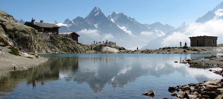
The Aiguille de Chardonnet (left) and the Aiguille d’Argentière (right) as seen from Lac Blanc.

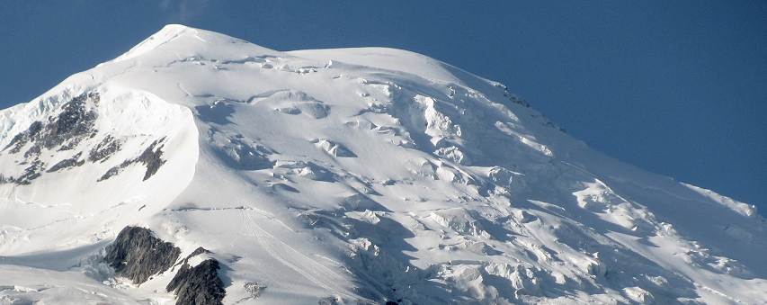
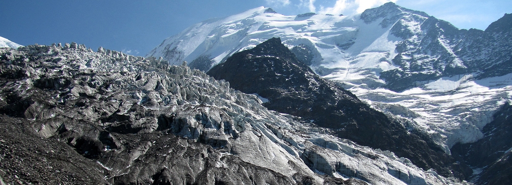
The Dôme du Goûter on the shoulder of Mont Blanc rises above Chamonix.
Pre-tour arrival day
Overnight in Chamominx, France
Arrive at Geneva, Switzerland and transfer on your own to the French mountain town of Chamonix set at the base of Mont Blanc. Geneva Airport is about one and a half hours by minivan shuttle from Chamonix.

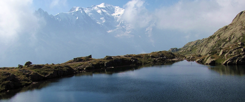
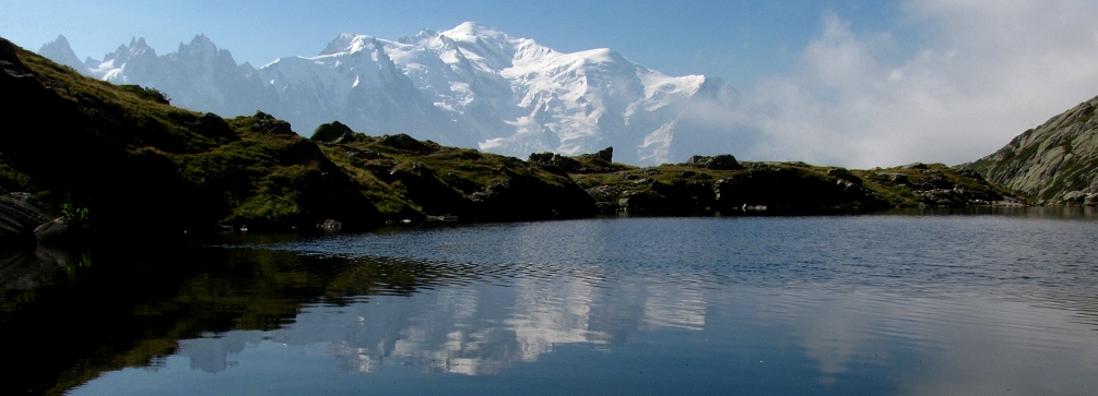
One of the Lacs de Chéserys and Mont Blanc in the background.
Day 1
Overnight in Chamonix
Ride a cable car up to La Flégère, a meadow-carpeted alpine “balcony” high above Chamonix. Hike to Lac Blanc and Lacs de Cheserys (from where Mont Blanc dominates the view to the south) before looping back to the cable car and descending back to Chamonix. If you have the energy and desire after completing the loop you can continue walking over the Col de la Glière from where you’ll enjoy a view of Lac Cornu and the north side of the Massif des Aiguilles Rouges. Continue to the Col du Lac Cornu and start a descent toward the Planpraz station of the Brevent cable car. Ride the cable car back down to Chamonix. Shorter hiking option (Flégère Loop): 1,700 feet of elevation gain and loss in about 5.3 miles. Longer hiking option is an additional 5 miles with an additional elevation gain of 2,300 feet and an additional elevation loss of 1,800 feet.
Day 2
Overnight in Chamonix
Transfer by vehicle from Chamonix to Le Tour where a cable car and chairlfit will whisk you to the Col de la Balme (7,182 ft). Begin your hike from here crossing almost immediately into Switzerland. The trail (the Vallorcine variant of the Tour du Mont Blanc) leads you beneath the peak known as the Croix de Fer and offers expansive views over Vallorcine valley and distant Lac d’Emosson. Pass the mountain farms of Catogne and Les Tseppes before entering the woods for the final descent to Trient, Switzerland. For a shorter hike, you can enjoy the lovely loop hike from the Col de Balme to the mountain farm of Catogne. After the hikes, return to Chamonix by vehicle. Shorter loop hike option: 1,000 feet of elevation gain and loss in about 4.3 miles. Longer hiking option: 300 feet of elevation gain and 3,300 feet of elevation loss in about 5 miles.

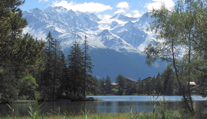
Mountain view from Champex Lac, Switzerland.
Day 3
Overnight in Champex, Switzerland
Travel by vehicle from Chamonix to the Col de la Forclaz. From here, a beautiful but challenging trail leads you to the lofty and impressive mountain pass of Fenêtre d’Arpette (7,430 ft). After a long but rewarding descent, with some chamois and ibex watching you on your way down, arrive at Champex-Lac and your overnight accommodations. For a shorter hiking option, travel by vehicle from Chamonix to Champex. Then take a chairlift up to the La Breya refuge perched at the end of a ridge above the lake of Champex. A thrilling trail (all above tree-line) contours along the ridge toward the Glacier d’Orny which spills from the ice-filled basin beyond the Aiguilles Dorées. Shorter hiking option: 1,700 feet of elevation and loss in about 5.5 miles (round trip). Longer hiking option: 3,750 feet of elevation gain and 3,900 feet of elevation loss in about 9 miles (about 7-8 hours).
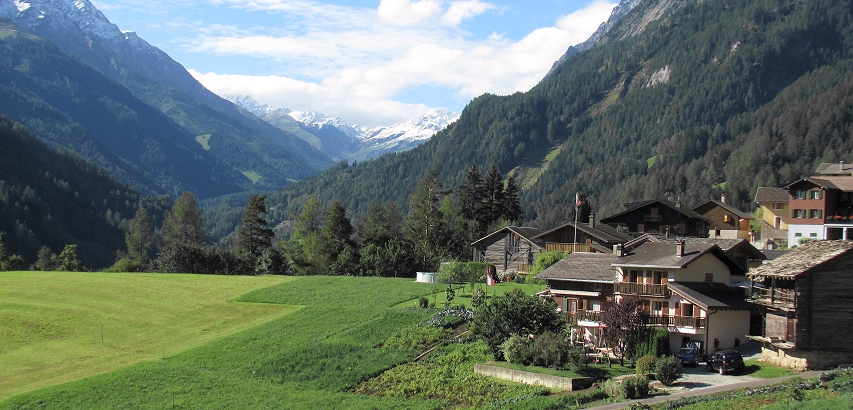
Looking up the Val Ferret from the village of Prassurny,Switzerland.

Day 4
Overnight in Courmayeur, Italy
A short transfer by vehicle brings you from Champex to the mountain hamlet of Ferret from where you begin your hike up into the high Val Ferret. Cross over into Italy at the Grand Col Ferret. From this high pass, you’ll descend along a steep but beautiful slope to reach the Italian Rifugio Elena (mountain refuge) which faces the Pré de Bar Glacier and the Mont Dolent. The last section of trail leads you to Arp Nouvaz (Arnuva). From here, a vehicle shuttle brings you to the Italian mountain resort town of Courmayeur where you will spend the night. The route over the Grand Col Ferret involves 2,750 feet of elevation gain and 2,500 feet of elevation loss (in about 8 miles) and will take about 5-6 hours. For a shorter hiking option, you can travel by vehicle to Courmayeur (about 2.5 hours) and hike to the Rifugio Bertone perched on a ridgetop above Courmayeur. The views of Mont Blanc and the surrounding valleys from this lofty vantage point are wonderful. The short option hike is about 6 miles in length (round trip) with about 1,400 feet of elevation gain and loss.
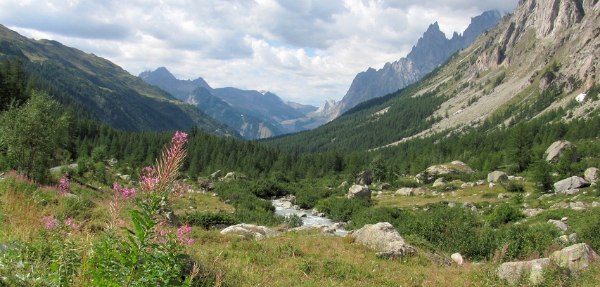
View down the Val Ferret, Italian side.

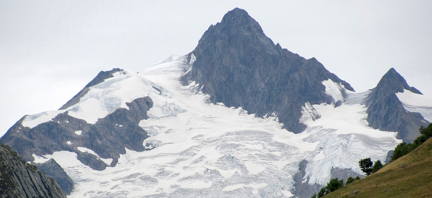
The glacier-clad Aiguilee des Glaciers rises above Ville des Glaciers.
Day 5
Overnight at Lac de Roselend or Beaufort, France
After a vehicle transfer from Courmayeur to the hamlet of La Visaille, start hiking up the Val Veni passing by the glacial lakes Miage and Combal. Continue beyond the Combal Lake, ascending to the Col de la Seigne (8,268 ft) where the route re-enters France. Continue down to the hamlet of Ville des Glaciers and transfer by vehicle to overnight accommodations near the Lac de Roselend. For a shorter hiking option, travel by vehicle from Courmayeur to the Col de Petit St. Bernhard (Small St. Bernard’s Pass). From here, a hike through open meadows leads to the small but lovely Lac Sans Fond (“Bottomless Lake”) offering a great view toward the ice-capped peak of Mont Pourri. After the hike, travel by vehicle to overnight accommodations at Lac de Roselend. Shorter hiking option: 1,000 feet of elevation gain and loss; about 3 miles round trip. Longer hiking option: 2,800 feet of elevation gain and 2,400 feet of elevation loss; about 10 miles (about 7-8 hours).
Mont Blanc yet gleams on high:
The power is there,
The still and solemn power
Of many sights and many sounds…
–PERCY BYSSHE SHELLEY, Mont Blanc
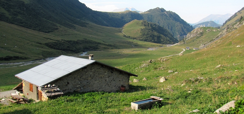
Peaceful morning at La Gittaz where the hike over the Col du Bonhomme begins.
Day 6
Overnight in Contamines-Montjoie, France
A short vehicle transfer this morning brings you to the tiny mountain hamlet of La Gittaz (5,462 ft) located in a broad alpine basin. Hike up the Col du Bonhomme (7,641 ft) then descend the famous Grande Randonnee 5 (GR5), a trail that crosses Europe from the Mediterranean to the North Sea. The route makes its way through gorgeous mountain scenery and passes over a section of old Roman road. Arrive at the lovely painted chapel of Notre Dame de la Gorge from where a vehicle shuttle carries you downhill to the village of Contamines-Montjoie and your overnight accommodations. The route over the Col du Bonhomme involves 2,300 feet of elevation gain and 4,300 feet of elevation loss in about 10 miles (about 7 to 8 hours). For a shorter outing, hike from La Gittaz to the Col du Bonhomme and return to La Gittaz. Then travel by vehicle to Les Contamines. The short hike involves a round trip distance of about 5.5 miles with an elevation gain and loss of 2,000 feet.
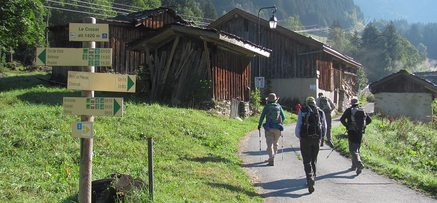
Hiking near Bionnassay.

Day 7
Overnight in Chamonix, France
Transfer by vehicle the short distance to Bionnassay from where you’ll begin your hike ascending under the Abrupts de Vorassay to reach the lowest part of the Bionnassay Glacier. From there, you’ll follow the GR5 to the Col de Voza and catch the Tramway du Mont Blanc down to Saint Gervais les Bains. Shuttle by vehicle to Chamonix and your overnight accommodations. A longer hiking option begins at La Frasse just above Contamines and ascends to the Chalets du Truc. The route then descends to the Chalets du Miage before re-ascending over the Col du Tricot to reach the Bionnassay Glacier and the Col de Voza. Descend via the Tramway du Mont Blanc to St. Gervais les Bains and shuttle to Chamonix where a farewell dinner and evening accommodations await! Shorter hiking option: 1,500 feet of elevation gain and 500 feet of elevation loss in about 4.5 miles (about 3-4 hours). Longer hiking option: 3,600 feet of elevation gain and 2,300 feet of elevation loss in about 8 miles (about 7 hours).
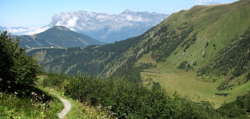
Hiking toward the Nid d’Aigle; the Col de Voza in the middleground.
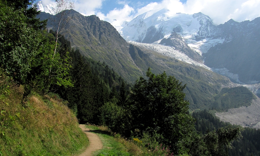
Trail near the Col de Voza.

Departure day
Transfer on your own to Geneva Airport and your onward connections.
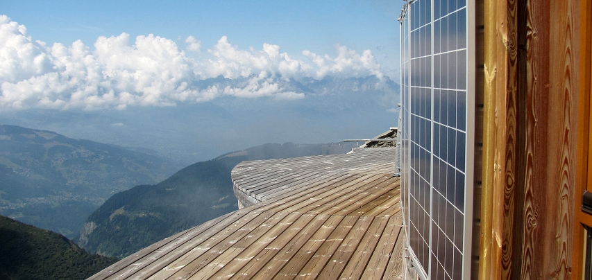
View from the Nid d’Aigle (Eagle’s Nest).
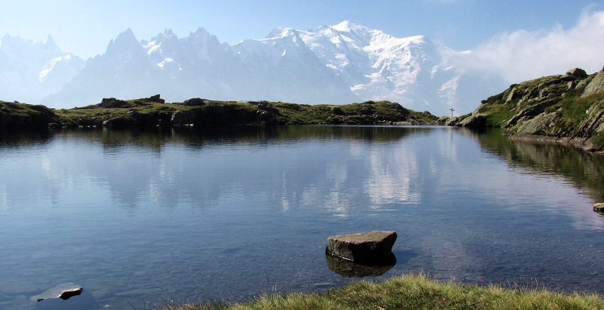
Mont Blanc reflected in the waters of the Lacs de Chéserys.

Photos on this page are by John Osaki (© All Rights Reserved) except as otherwise credited.


