Hiking the Picos de Europa
Crown of Spain’s Cantabrian Mountains

Explore the Cantabrian Mountains (Cordillera Cantábrica), a three-hundred mile long range that graces the northern coast of Spain. This trip begins with a selection of hikes in the Somiedo Nature Reserve (Parque Natural de Somiedo), a rugged massif of limestone summits in Spain’s Principality of Asturias. The park, named a Biosphere Reserve in 2000 by UNESCO, protects high country meadows, lakes and cirques along with forests of beech, oak and birch and serves as a refuge for wildlife including golden eagles and chamois. The hiking continues in the Picos de Europa, a cluster of high limestone peaks straddling the border between the provinces of Cantábria and Asturias. Here, austere, lunar-like landscapes filled with large, rocky depressions called jous contrast with green mountain meadows (vegas), accented by picturesque tile-roofed mountain farms (majadas). The serene alpine lakes of Covadonga and the narrow defile of the Cares Gorge await your discovery. Enjoy overnights in small, comfortable mountain inns filled with character and typical of the area. Immerse yourself in the varied landscapes and distinctive cultures of Asturias and Cantábria at the heart of España Verde (“Green Spain”).

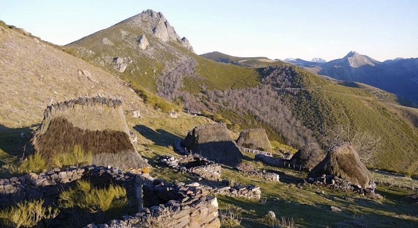
Thatch-roofed huts (teitu) accent a mountain meadow in the Somiedo region, Cantabrian Mountains. (Photo by R. Bascuñana)
Day 1
Overnight in the Somiedo Valley
Travel by vehicle from Oviedo to the Somiedo Valley at the heart of the Somiedo Nature Reserve (Parque Natural Somiedo). Today’s hikes start from the mountain hamlet of El Llamardal from where a trail ascends to the Braña de Mumian, a ridgtop expanse of meadow accented with picturesque thatch-roofed stone huts (known as “teitu”) and rambling stone walls. (Braña is a term used in Asturias and Cantabria meaning a high mountain pasture or meadowland.) After surveying the views of the surrounding peaks, descend from the Braña de Mumian through the beech woods of the Hayedo de La Enraimada to reach the picturesque village of El Coto de Buenamadre. You can end your walk here, or continue on foot to the town of Pola de Somiedo which will serve as your base for three nights.

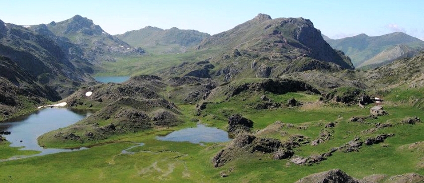
Meadows and peaks at the Lagos de Saliencia, Somiedo Nature Reserve. (Photo by R. Bascuñana)
Day 2
Overnight in the Somiedo Valley
Travel by vehicle to the mountain pass of Alto de la Farrapona (over a mile high) in the Somiedo Nature Reserve which has been designated a Biosphere Reserve by UNESCO. Today’s hikes will take you through a high mountain valley to the Lakes of Saliencia (Lagos de Saliencia). Hike to the Lago de la Cueva and continue to two higher lakes—Lago Calabazosa and Lago Cerveriz set in luxuriant pasturelands. Those seeking a longer hike can continue from Lago Cerveriz to the wide-open meadows of the Vega de Camayor and the Braña de Sobrepena and on to the village of Valle del Lago.
Day 3
Overnight in the Somiedo Valley
Travel by vehicle to the San Lorenzo pass where you’ll set off on a hike to the peak of Peña Michu. From the pass, ascend gradually through lovely open country. At the Braña de Piedraxueves, you’ll see the open slopes leading up to the broad summit of Peña Michu from where, on a clear day, you can gaze northward to the Cantabrian Sea. From the summit descend into the neighboring valley to reach the village of Arbeyales via a spectacular trail that threads the narrow limestone gorge known as La Guergola. A less strenuous hiking option takes you from San Lorenzo pass to the picturesque Braña de Rebellon and Braña de Tuiza. Return by vehicle to your accommodations in the Somiedo Valley.

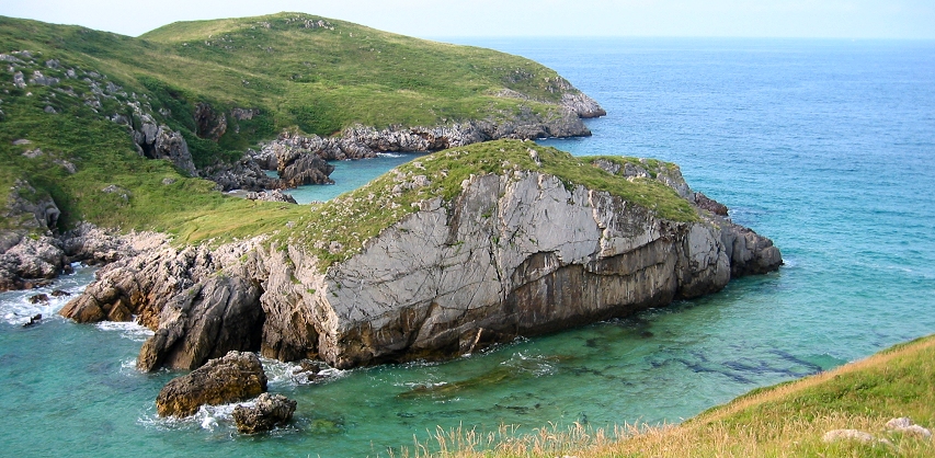
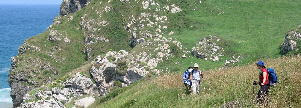
View from the Senda Costera near Llanes.
Day 4
Overnight in Mestas de Con
Travel by vehicle to the Asturian seacoast. Today’s hike is along the Senda Costera (“Coastal Path”), a hiking route that leads you along the supremely picturesque Asturian coastline along cliff-tops, past fjord-like inlets (known as rias) and across the sands of half-moon coves. Portions of this coastline are somewhat reminiscent of the coast of southwest Ireland which lies about six hundred miles to the north! One the many scenic features you’ll encounter on the hike is the curious Playa Gulpiyuri, a sandy cove with a subterranean connection to the sea. After the hikes, travel by vehicle across the Sierra de Cuera to Mestas de Con in the valley of the Rio Güeña where you’ll spend the next three nights.
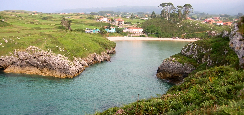
The fjord-like Ria de Poo on the Asturian coast.

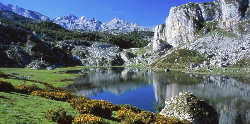
Lago de Ercina.
Day 5
Overnight in Mestas de Con
Travel to the high country lakes of Lago Enol and Lago de la Ercina in the northwestern portion of the Picos de Europa National Park. (This area served as the core of the old Covadonga Mountains National Park, Spain’s first national park established in 1918. The park was later expanded and in 1995 was designated as the Picos de Europa National Park.) Today’s hike will take you into the heart of the Cornión massif, one of three that make up the Picos de Europa. The shorter option hike loops around the two Covadonga lakes (Enol and Ercina) and passes a couple of picturesque mountain farms (majadas) set in green meadows ringed with limestone peaks. A longer hiking option takes you from the end of the trail at Vega Huertu climbing a gentle slope to Collado la Pida from where the trail leads through wonderful meadows to the Vegaredonda mountain hut. From there, the trail keeps ascending to another small refugio by the side of the Mirador de Ordiales which commands a bird’s eye view over the Ozania valley. Return to the car via the same trail and travel by vehicle back to Mestas de Con for the evening.
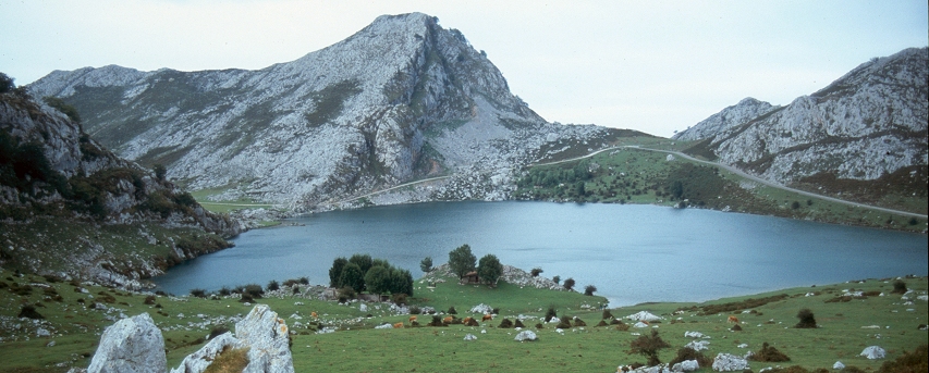
Lago de Enol and the Majada la Piedra.
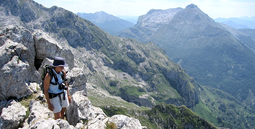
At the Mirador de Ordiales.

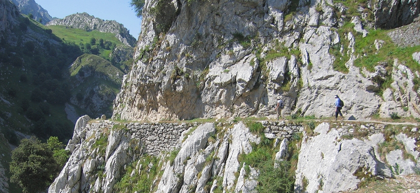
Hiking in the Cares Gorge.
Day 6
Overnight in Mestas de Con
Today you’ll enjoy one of the most spectacular canyon walks in Europe as you traverse the deep and narrow Cares Gorge (Garganta del Cares). Start the day with a spectacular drive from Mestas de Con around the Picos massif to the small settlement of Cain situated at the southern entrance to the Cares Gorge. From Cain the trail quickly enters the Cares Gorge, and you’ll find that the walls of the canyon become progressively higher as you proceed into it. Near the start of the hike, you’ll pass through tunnels blasted into the canyon walls before crossing a stunning bridge that spans a narrow portion of the canyon. From that point, the trail keeps a nearly level contour having been blasted into the canyon’s western wall about five hundred feet above the streambed. The trail is well-maintained and the views are glorious throughout the walk. The hike is mostly downhill except for a short uphill climb as you approach the trail’s end near the village of Poncebos. At Poncebos, a vehicle will be waiting to take you back to Mestas de Con. After this day you will understand why this hike is a true Picos de Europa classic!
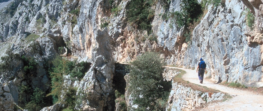
On the trail in the Cares Gorge.

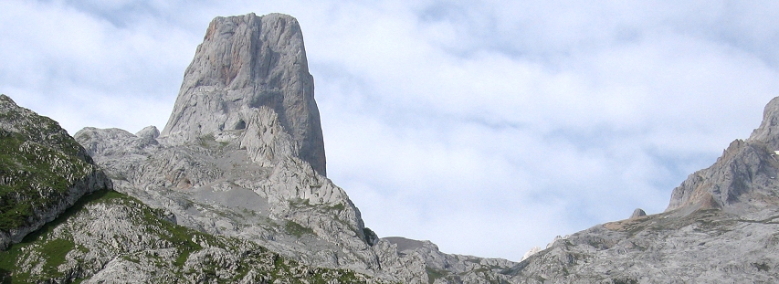
The Naranjo de Bulnes as seen on approach from the Collado de Pandebano.
Day 7
Overnight in the Liébana Valley
Hike into the the Urrieles massif, perhaps the most dramatic of the three mountain groups that make up the Picos de Europa. Travel by vehicle to the trailhead just below the Collado de Pandebano in the highlands of the Picos de Europa. From this grassy pass you can descend on foot to the isolated and lovely mountain settlement of Bulnes, hemmed in by steep valley walls. From Bulnes you can continue follow a canyon trail to the hike’s end at Poncebos. Or, if you’d rather, you can hop aboard an underground funicular that will take you comfortably from Bulnes to Poncebos. For a more strenuous trail adventure, hike steadily upward from the Collado de Pandebano through green meadows. The route eventually breaks into open, rocky terrain before reaching the Refugio J. Delgado Ubeda set in the stony meadow of the Vega de Urrieles at the base of the Naranjo de Bulnes, a massive limestone monolith and the signature peak of the Picos de Europa. After the hike, return to the Liébana valley and enjoy cuisine typical of the region.
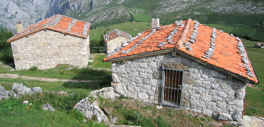
The Majada de la Terenosa above Bulnes.

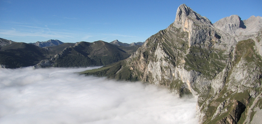
Spectacular view from the upper station of the Fuente De cable car.
Day 8
Overnight in the Liébana Valley
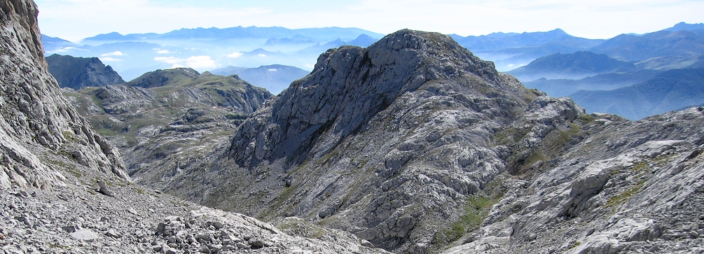
Travel by vehicle to Fuente De at the upper end of the Deva river valley. Ascend by cable car to the upper terminus at El Cable then set off on a path leading through lunar-like limestone landscapes to the pass known as the Horcados Rojos. At the pass you are at the heart of the Picos de Europa. Below you lie the large limestone depressions known as the Jou de los Boches and the Jou Sin Tierres, and in the distance you’ll see the distinctive spire of the Naranjo de Bulnes. For a more challenging hiking option, follow a path that leads from the cable car station into the depression called the Hoyos de Lloroza. The route continues up the Canal de San Luis to gain the pass of Colladina de las Nieves. Herds of chamois, or rebecos, are often seen in this area. A short distance beyond, the summit of Pico de la Padierna offers astounding almost aerial views over the green meadows of the Vega de Liordes to the south. To the west, the jagged peaks of the Cornión massif march across the horizon. At the end of the day, descend by cable car to the starting point and return the Liébana valley by vehicle.
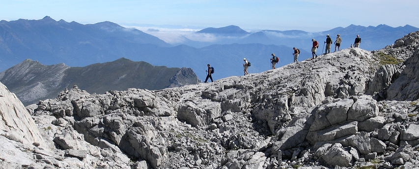
Hikers descending from the Pico de la Padierna.

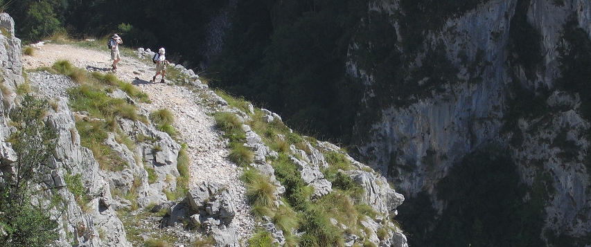
Hikers above the canyon of the Rio Urdon.
Day 9
Overnight in Gijon
Today, you will hike at the beautiful woods of the Sierra de Bejes. After a short drive to the remote village of Bejes, begin your hike from the pass known as the Collado de la Hoja from where the trail proceeds along the mountain ridge that separates the impressive canyon of Rio Urdon from the Bejes Valley to the south. The trail passes through meadows and beech groves going from one abandoned invernal to another. (Invernales are ancient stone barns that were built to protect livestock during the cold months.) The path proceeds to the Collado Osina (pass) from where the trail descends the main road in the dramatic canyon known as the Desfiladero de la Hermida. After the hike, travel by vehicle to the seaside town of Gijon. Enjoy a farewell dinner to celebrate the conclusion of your Cantabrian Mountains adventure!
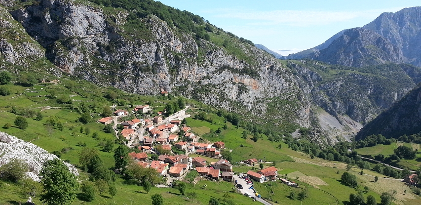
Lovely villages like Bejes grace the high valleys on the eastern slope of the Picos. (Photo by R. Bascuñana)

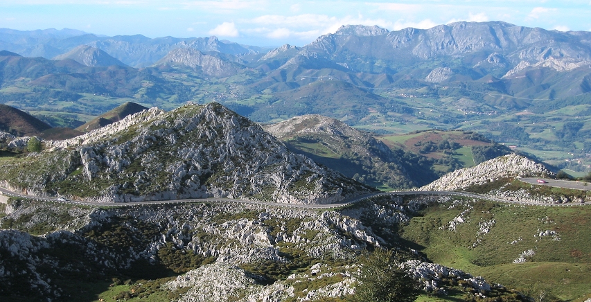
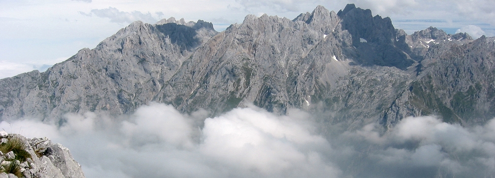
View over the Cantabrian Mountains from near the Covadonga Lakes.
Other Resources
![]() Bilbao’s titanium-clad Guggenheim Museum designed by architect Frank O. Gehry dominates the re-developed banks of the Nervión River. The museum’s website offers information on the history of the museum and the building that houses it as well as information about the museum’s permanent collection, exhibitions, and education programs.
Bilbao’s titanium-clad Guggenheim Museum designed by architect Frank O. Gehry dominates the re-developed banks of the Nervión River. The museum’s website offers information on the history of the museum and the building that houses it as well as information about the museum’s permanent collection, exhibitions, and education programs.
![]() The Somiedo Nature Reserve (Parque Natural Somiedo) protects a portion of the limestone mountains of Asturias. Check out this website (maintained by the Somiedo Nature Reserve’s Center for Interpretation) for information on the park’s natural and cultural features, flora, fauna, etc. In Spanish.
The Somiedo Nature Reserve (Parque Natural Somiedo) protects a portion of the limestone mountains of Asturias. Check out this website (maintained by the Somiedo Nature Reserve’s Center for Interpretation) for information on the park’s natural and cultural features, flora, fauna, etc. In Spanish.
![]() PicosdeEuropa.net contains a variety of information about the Picos de Europa National Park primarily geared to climbers and other outdoor enthusiasts. The site has a section containing a wealth of panoramic photographs of the Picos as well as the mountains of Asturias province; click on the “Panorámicas” link on the site’s home page.
PicosdeEuropa.net contains a variety of information about the Picos de Europa National Park primarily geared to climbers and other outdoor enthusiasts. The site has a section containing a wealth of panoramic photographs of the Picos as well as the mountains of Asturias province; click on the “Panorámicas” link on the site’s home page.
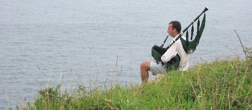
A gaiteiro plays his bagpipes (gaita) on the cliff-tops of the Asturian coastline near Llanes.
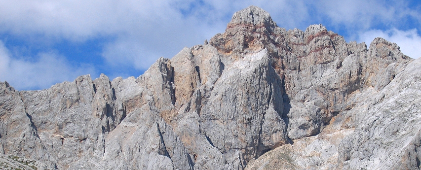
Peña Vieja en route to the Horcados Rojos.
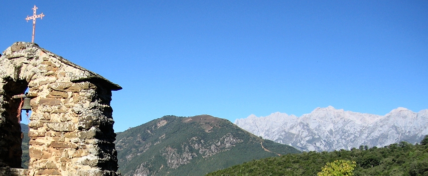
A view of the Picos de Europa from a hamlet in the Liébana valley.

Photos on this page are by John Osaki (© All Rights Reserved) except as otherwise credited.


