Hiking in the Azores
Mid-Atlantic Hikes in the Blue Isles

Azores Slide Show for iPad & iPhone

Anchored in the cobalt Atlantic Ocean, the temperate islands of the Azores boast some of Portugal’s most dramatic mountains. The Azores, along with the Canary, Cabo Verde and Madeira Islands are mid-Atlantic volcanic archipelagos that comprise the island region known by geographers as Macaronesia (“blessed islands”). The islands are the highest summits of great submarine mountain ranges that include the Mid-Atlantic Ridge, the world’s longest mountain range. Broad calderas, cone-shaped volcanoes, steep-walled ravines, and plunging sea cliffs are typical of the Macaronesian landscape. The Azores are a cluster of nine islands about nine hundred miles west of Lisbon and known as Açores in Portuguese. They comprise an autonomous regions of Portugal; in fact the highest mountain in Portugal is the Azorean stratovolcano, Pico (7,714 feet). These subtropical islands boast a wealth of endemic plant species as well as remnants of laurisilva forest, a type that covered much of southern Europe in the Tertiary age. The islands have been referred to by various names over time including Ilhas Afortunadas (“Fortunate Isles”) and Ilhas Azuis (“Blue Isles”). It is commonly said that the current name of the islands derives from açor, the Portuguese word for the goshawk.

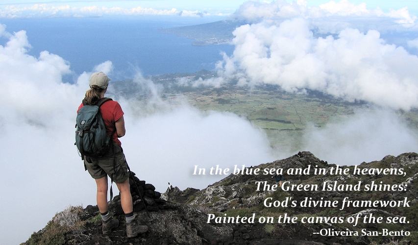
Surveying the view from cloud-swept Pico volcano looking toward the island of Faial.
Arrival day
Overnight in Furnas
We’ll meet you upon your arrival at Ponta Delgada Airport and transfer you to your hotel in the picturesque town of Furnas set in the middle of one of São Miguel’s four large volcanic calderas. Today much of the Furnas caldera is blanketed in lush pastureland crisscrossed by hydrangea hedgerows—a landscape typical of the Azores. But here and there, thermal springs and fumaroles issue from the earth, reminders of the volcanic upheavals that lifted the Azores from the depths of the Atlantic. Spend the afternoon wandering on your own through the Terra Nostra Gardens filled with native and exotic plants including tree ferns. The gardens contain about 2,500 trees and plantings of native Azorean species. Enjoy a welcome dinner featuring cozido nas caldeiras, a combination of meats and vegetables cooked in a sealed pot in the steam of the local hot springs.

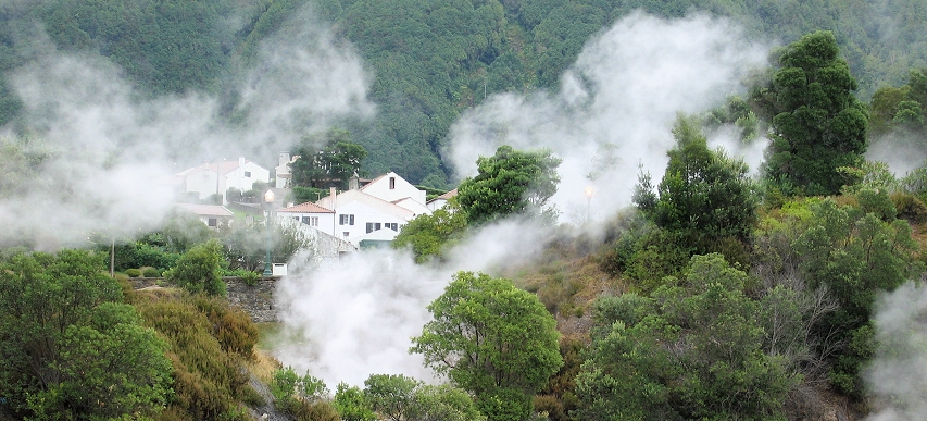
Steam from the geothermal areas wreaths houses in Furnas, São Miguel.
Day 1
Overnight in Furnas
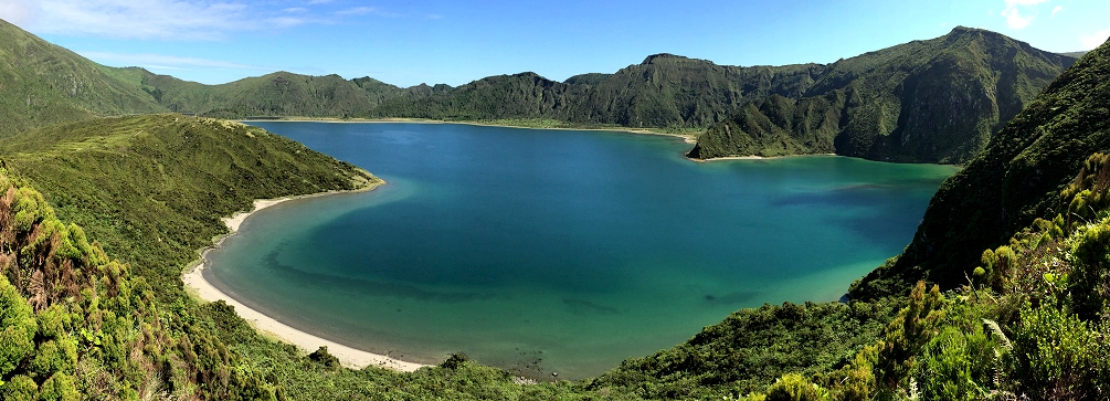
Today, you can either hike around the Lagoa das Furnas, or hike up to the Lagoa do Fogo. Both lakes are “crater lakes,” or more correctly, “caldera lakes.” The hike around the Lagoa das Furnas includes a visit to the caldeiras (“thermal area”) along its northern shore where you may see locals setting sealed canisters of meat and vegetables (cozidos) into holes in the steaming earth to cook. Follow the lakeshore path through stands of Crytomeria trees and bamboo groves. Loop back to town and proceed to the Caldeiras das Furnas, a miniature Yellowstone with vigorously gurgling hot springs. The hike to the Lagoa do Fogo is more of a workout. From São Miguel’s south coast, a path ascends steadily through field, pasture, and woodland and eventually enters high altitude scrublands where tree heathers (Erica sp.) dominate. Mists often swirl around the Lagoa do Fogo and the cries of seagulls, unexpected in this high mountain landscape, add to the “lost world” atmosphere of the place. From the lake, descend to the coast via an alternate path. En route, follow the course of an Azorean levada (irrigation channel) though lush greenery before descending through eucalyptus woods to the sea at Bahia da Praia. Return to Furnas for the evening.
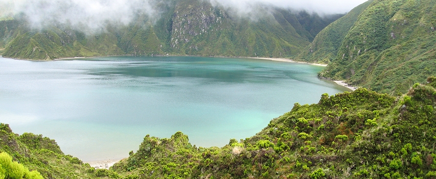
Mist clings to the cliffs that hem in volcanic Lagoa do Fogo.

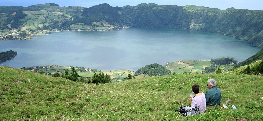
Trail lunch with a view! Lagoa Azul from the rim of the Sete Cidades caldera.
Day 2
Overnight in Ponta Delgada
Hike along the rim of the Caldeira das Sete Cidades (“Caldera of the Seven Cities”). This vast volcanic caldera holds two large lakes—Lagoa Azul (“Blue Lake”) and Lagoa Verde (“Green Lake”). Two other lakes—Lagoa de Santiago and Lagoa Rasa—are cupped in smaller volcanic cones that rise from the floor of the main caldera. The classic view of the Caldeira das Sete Cidades is that from the Vista do Rei (“View of the King”) on the caldera’s southern rim. Today’s hikes take you along the far less visited but equally scenic western and northern rims of the caldera. The shorter hiking option concludes at the Miradouro da Cumeeira, a viewpoint on the northern caldera rim, a thousand feet above the waters of the Lagoa Azul. The longer hiking option continues down the northern slopes of the Sete Cidades volcano through green pasturelands to reach the rocky shores of the Atlantic at the beautiful town of Mosteiros (“monasteries”). Enjoy this evening at a hotel in central Ponta Delgada, the administrative capital of the Azores.
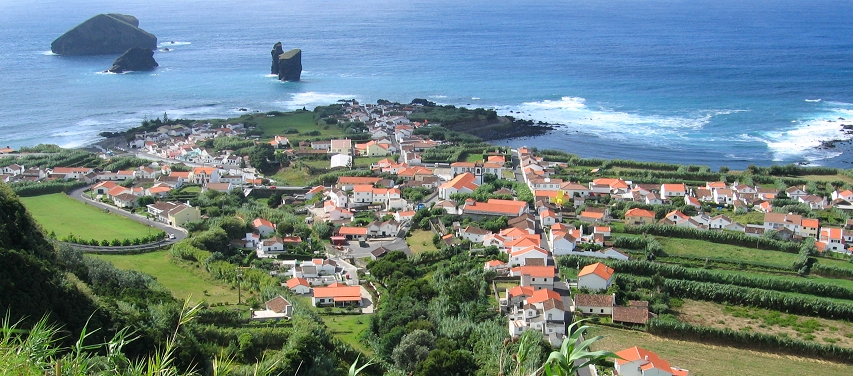
The lovely seaside town of Mosteiros at the conclusion of the Sete Cidades hike.

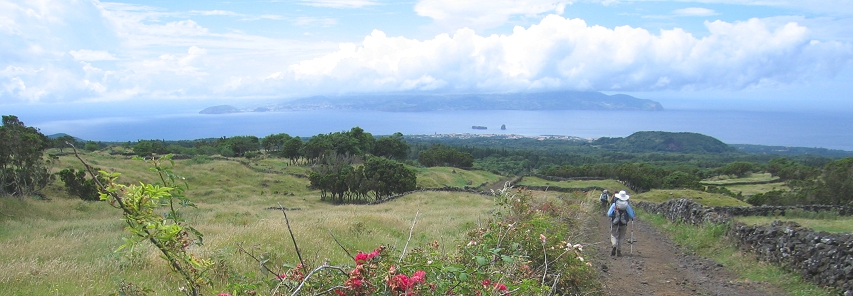
Hiking to Madalena from Furna Frei Matias, Pico.
Day 3
Overnight in Madalena
This morning, depart Ponta Delgada by air bound for the island of Pico. Upon arrival on Pico, travel to Madalena, the island’s principal town. Today, you’ll explore the lower slopes of the beautiful cone-shaped Pico volcano (Portugal’s highest mountain at 7,714 feet) on a one-way hike from the Furna de Frei Matias (“Brother Matthew’s Cave”) back to Madalena. Furnas de Frei Matias is a beautiful lava tube large enough to walk through. After visiting the cave, head down slope along farm lanes and tracks through the lovely, “park-like” setting of “up-country” Pico. Lush fields and pasturelands lined with hydrangea hedges and lava rock walls dominate the scene. Here and there, fine specimens of heather trees (Erica azorica) punctuate the landscape. After a while, pastureland gives way to orchards of apple and citrus trees. The route continues on an easy downhill grade passing old cinder cones, a few picturesque stone houses, and the well-tended gardens of the Quinta das Rosas. As you near Madalena the route passes some examples of the stone enclosures called currais in which Pico’s wine grapes are grown. Shortly thereafter, reach the Pico Wine Museum (Museu do Vinho) where there are fantastic specimens of “dragon trees” (Dracaena draco) in the museum’s compound. The hike continues to its conclusion in Madelena town. For a shorter hike, you can walk just part of this route. Overnight at a sea-front hotel in Madelana.
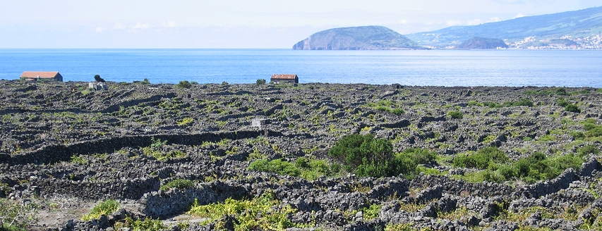
Grape growing enclosures (currais) at Lajido. Pico’s vineyards are a World Heritage Site.

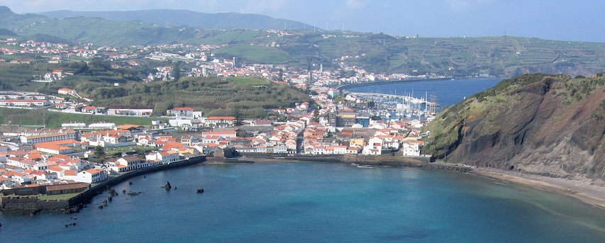
Horta town on the island of Faial.
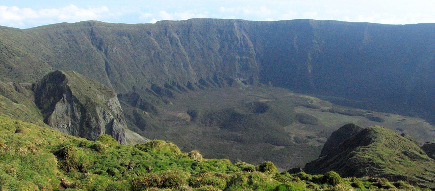
View into the Faial caldera from the rim.
Day 4
Overnight in Madalena
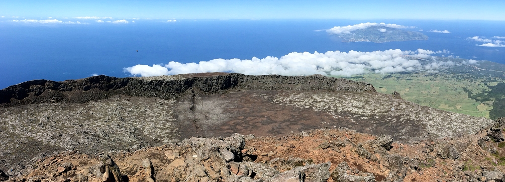
Today, choose between a hike around the rim of the Faial caldera (on the neighboring island of Faial) or the ascent of the 7,714 foot tall Pico volcano, Portugal’s highest mountain. The Faial caldera hike starts with a thirty minute morning ferry ride across the Faial Channel from Madalena on Pico island to the town of Horta on Faial island. Horta is the legislative capital of the Azores autonomous region. From the ferry terminal in Horta, travel by vehicle up to the Miradouro da Caldeira on the rim of the Faial caldera at an elevation of about 2,950 feet. From this point, you can walk around the rim of the caldera in about three hours. En route, you’ll pass over the Cabeço Gordo peak, the highest point on the rim and the summit of Faial island. The Faial Caldera is about 1.25 miles in diameter with an average depth of 1,300 feet and the entire summit area is classified as a nature reserve. The other hiking option will take you to the summit of the Pico volcano. Standing atop this isolated peak surveying the wild expanse of the Atlantic Ocean surrounding you on all sides is a thrill that no “land-bound” volcano can offer. On a clear day it’s possible to see all five islands of the Azores’ central group! At the top of the volcano is a rather large, flat-floored, caldera-like structure out of which rises the rocky spur of a peak known as Piquinho. A short scramble brings you to the top of Piquinho for a never-to-be-forgotten view! Pico volcano also is home to a plant found nowhere else in the world: the sea campion (Silene vulgaris subsp. cratericola) found on the rim and crater floor of the volcano between 2,100 and 2,300 meters above sea level.

Pico volcano shakes off the morning clouds.
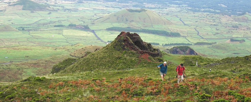
Hiking on the slopes of Pico volcano.

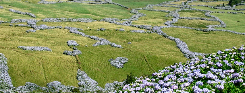
Hydrangea hedgerows twist across the São Jorge highlands, a quintessential Azorean summer scene.
Day 5
Overnight in Velas (São Jorge)
Travel on the morning ferry from Pico island to Velas harbor on São Jorge island. Today’s hike leads from the Pico das Caldeirinhas across the scenic São Jorge highlands covered in verdant pasturelands crisscrossed by hydrangea hedgerows. Numerous volcanic cones cloaked in a luxuriant growth of grasses pockmark the landscape while to the south the ever-present silhouette of Pico volcano floats over the deep blue waters of the Atlantic. The route descends gradually through the highlands passing through the Portal do Cedro and on past the picturesque village of Santo Amaro to its conclusion in Velas town. If you’re in the mood for more hiking you can add an afternoon hike to the Fajã do João Dias, a flat tongue of land jutting out into the ocean at the base of the high sea cliffs lining São Jorge’s northern shores. The trail to the Fajã do João Dias descends the cliffs via an old mule track providing an exhilarating trail experience! Today, the Fajã do João Dias is semi-abandoned, but pack mules still make the occasional journey down the old cobbled access trail to carry supplies to the few residents who still remain.
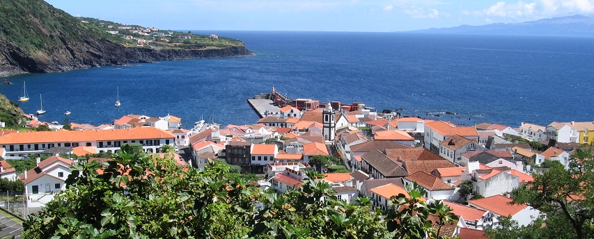
Trail’s end in picturesque Velas town, São Jorge.
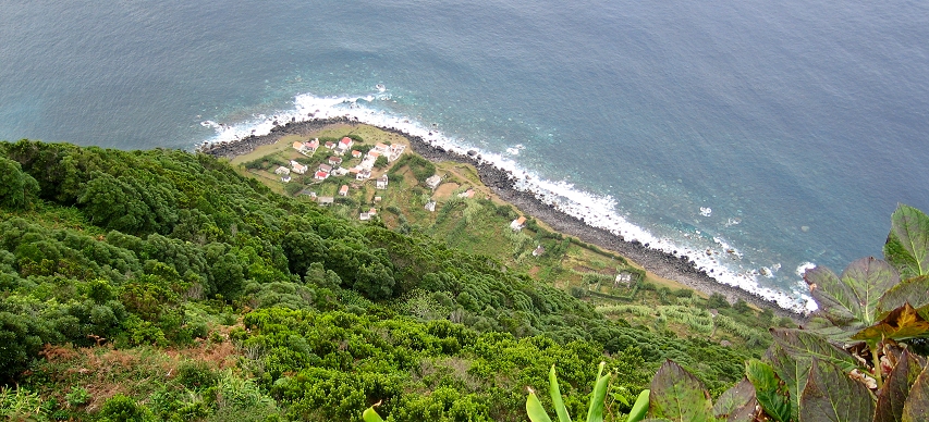
Looking down on the Fajã do João Dias, São Jorge.

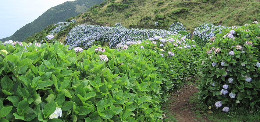
Trail leading through the hydrangeas, Serra da Topo, São Jorge.
Day 6
Overnight in Velas (São Jorge)
The hike from the Serra do Topo in the São Jorge highlands to the Fajã dos Cubres is probably the finest hike on São Jorge and one of the best in the Azores. The hike is dramatic and spectacular for its entire distance. From the trailhead high in the Serra do Topo, the trail begins its twisting descent through heather forests into the deep-green, amphitheater-headed stream valley of the Caldeira de Santo Cristo. Clusters of pink blossomed Amaryllis belladonna, a South African import, line portions of the trail. The trail levels out upon reaching the Fajã da Caldeira de Santo Cristo with its brackish water lagoon where cockles (Tapes decussatus) thrive. A few people maintain a residence on the fajã. Leave the fajã by heading in a northwesterly direction on the undulating trail along the coast. Waterfalls tumble down the 2,000 foot cliffs; bird song and crashing waves create an endless symphony! Hike past the Fajã dos Tijolos and the Fajã do Belo to trail’s end at the Fajã dos Cubres. An easier hiking option begins at the Fajã dos Cubres and continues along the coast to the Fajã da Caldeira de Santo Cristo before returning to the starting point.
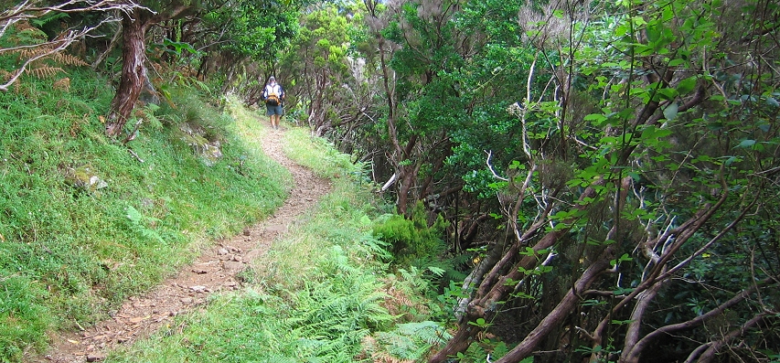
Hiking through fragrant woods on the beautiful trail to the Fajã da Caldeira de Santo Cristo, São Jorge.
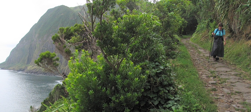
The old cobbled trail to the Fajã da Caldeira de Santo Cristo, São Jorge.
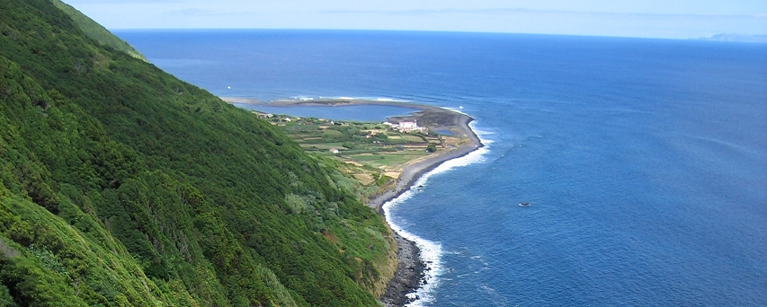
Almost there! A view of the Fajã da Caldeira de Santo Cristo, São Jorge.

Day 7
Overnight in Velas (São Jorge)
Today, hike along the south coast of São Jorge island. The hikes along the south coast are similar to those along the north—the cliffs are dramatic (as on the north coast) but the area is more settled and this provides for a nice contrast. From the trailhead at the Fajã dos Vimes the trail proceeds along the coastline to the Fajã dos Bodes from where it makes an ascent to the settlements at Lourais. On the ascent enjoy the views westward along the São Jorge coastline and across the water to Pico island. Near Lourais, the path crosses the Ribeira do Salto (stream) where a waterfall plummets down the mountainside. The trail descends to reach the first terraced fields of the settlement at Fajã de Além. Further below, you’ll likely encounter people working in their fields of bananas, corn, yams, potatoes and grapes. Pass through the picturesque settlement on the rocky Fajã de São João where you can pause to enjoy this lovely seaside village. Beyond the Fajã de São João the path begins an ascent up an old switchbacking path to avoid sheer coastal cliffs. The trail “tops out” in the lush pasturelands near the village of São Tomé where the hike ends. For a shorter version of this hike, you can opt to begin the hike at Lourais instead of the Fajã dos Vimes.
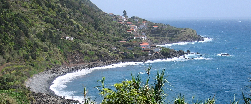
View of the village of Fajã São João on the south coast of São Jorge.
Other Resources
![]() Read Isles Apart, a magazine article in the April 2005 issue of Travel and Leisure Magazine for one traveler’s impressions of São Miguel island.
Read Isles Apart, a magazine article in the April 2005 issue of Travel and Leisure Magazine for one traveler’s impressions of São Miguel island.
![]() Check out Flora dos Açores for a great introduction to Azorean flora! Lots of photos. In Portuguese.
Check out Flora dos Açores for a great introduction to Azorean flora! Lots of photos. In Portuguese.
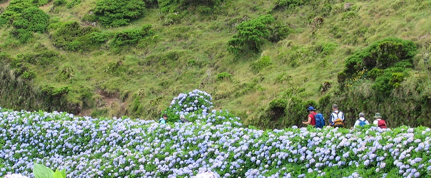
Hydrangeas along the trail, São Jorge.

Photos on this page are by John Osaki (© All Rights Reserved) except as otherwise credited.


